


This counter-map was the product of a collaboration between the Junior Philippine Geographical Society – University of the Philippines Diliman (JPGS-UPD), the Save San Roque Alliance, Kadamay – San Roque, and most especially the urban poor residents of San Roque.
The Beginnings
Counter-mapping has been the main methodology and practice of our organization, as it believes that the discipline of geography can be an effective tool in addressing pressing issues in Philippine society. The perceived concept of spaces as mere containers of different occurrences and phenomena is something that counter-mapping tries to transcend. Instead, counter-mapping is a highly political method that shows spaces as continually produced and engaged through processes centered around human influences. The participation of the marginalized sectors in the process of mapmaking, and in turn claim-making, is a very profound and fundamental part of counter-mapping. Counter-maps should always serve the interests of the marginalized. Mapping for the people is possible because there is mapping from the people.
Contour: Mapping for the People is a project that was first conceptualized during the fifth founding year of the Junior Philippine Geographical Society – UP Diliman (JPGS-UPD ) as spearheaded by its Sociocultural Activities Committee. With its commitment to bring the discipline closer to the people, the Contour project is aimed at providing an avenue for the discussion about space, power, discourses of development, and land dispossession. Alongside such discussions, the project also concerns itself in engaging in these contested spaces, and to understand the people’s everyday experiences.
Our organization, JPGS-UPD, held its first Contour project in Sitio Buntog, Barangay (Village) Canlubang, Laguna, where Hacienda Yulo is located. Its main objective was to reach out to the sugarcane workers, who were working in lands that are privately owned by the Yulo family, and personally learn from their stories.
In the following year, JPGS-UPD went to one of the most controversial haciendas in the Philippines — Hacienda Luisita in Tarlac province. A series of counter-maps were created, aimed at generating further discussions about peasants’ and workers’ conditions in agricultural production and the failed promises of agrarian reform in the country. In 2018, Contour brought us to Pandi, Bulacan. Pandi is a second-class urban municipality in the province of Bulacan and is home for various idle and substandard housing projects of the National Housing Authority (NHA). One of these housing projects, called ‘Atlantika,’ is located in Barangay Mapulang Lupa, Pandi, Bulacan. These housing units were occupied by the members of the urban poor group, KADAMAY (Kalipunan ng Damayang Mahihirap, Federation of Mutual Aid for the Poor), because of the decades of neglect from the Philippine government.
After four Contour projects, we decided in 2019 to launch Contour: ‘Balik-Tanaw,’ which translates to ‘in retrospect.’ The idea behind this spin-off is to revisit the communities we had engagements with in the past and update the outputs we left in the community. This is also motivated by our belief that as budding scholar-activists, we need to always reflect and enrich our own praxis in conducting research with communities by building meaningful relationships and standing in solidarity with them. It is also a way to instill in our new members the understanding that research should not be extractive, it should not reinforce existing power relations, and it is not partial or neutral.

Official social media poster of Contour: Balik-Tanaw.
The Community
Sitio San Roque is a self-built, urban poor community that sits on public land in North Triangle, Barangay Bagong Pag-asa, Quezon City. At its peak, it was home to an estimated 17,000 families, who mostly migrated from rural to urban areas after the fall of the dictatorship of Ferdinand Marcos in 1986. This is often referred to as the EDSA Revolution, because so many protesters assembled on one of Manila's main avenues, Epifanio de los Santos, or EDSA. Over the years, the number of families living in the community has dwindled down as manifestations of neoliberal urban development slowly encroach on the area. Particularly through Executive Order 620-A, signed by former President Gloria Macapagal-Arroyo, with the support from the World Bank, which authorized the construction of Quezon City Central Business District (QC-CBD). This project was envisioned to transform northern Metro Manila to be “globally competitive and be the center of gravity of all commercial activities.”
For the QC-CBD plan to materialize, the National Housing Authority, together with the Quezon City Local Government Unit, entered a public-private partnership with the private realty developer, Ayala Land Incorporated. More specifically, a joint venture was formalized in 2009 and was unveiled to the public in 2012. This commercial and business hub will be comprised of high-end residences, malls, business offices, entertainment parks, and other facilities. Part of the masterplan is the newly constructed mixed-used building, Vertis North by Ayala Land, and the ongoing Solaire North, a resort and casino by Bloomberry Resorts Corporation.
This development project meant militarization and surveillance, forced evictions, violent displacement, and terrorist-tagging for the thousands of urban poor families living in San Roque. Private developers have used various tactics to intimidate the residents and fragment the community, so they would eventually accept resettlement to far-flung areas. It was in 2010 when a large-scale demolition happened and it wasn’t the last.
“With the lapsing of another seven-day demolition notice, hundreds of residents led by Kalipunan ng Damayang Mahihirap (KADAMAY) barricaded Agham Road and EDSA and violently clash with a team of 600 police personnel, firemen, and volunteers. The stand-off lasted six hours, causing a massive traffic jam on EDSA and resulting in at least 18 injuries.” (Quoted from San Roque Primer written by Save San Roque Alliance.)
Due to the widespread media coverage of the 2010 incident, the strategy of NHA-Ayala shifted to “voluntary” and “pocket-sized” forced demolitions. They also became “creative” in uprooting the residents from the community. Strategies such as bribery, trumped up charges, arson, and destroying community relations through infiltration and cooptation of grassroots organizations were utilized.
Despite these attacks, the urban poor of Sitio San Roque are firm in their stand to struggle for their right to the city through their Community Development Plan (CDP).
“The CDP is a counterproposal that allows urban poor communities to build capacity and confidence, to create a stronger platform allowing communication with authorities and with a broader audience, to allow sidelined citizens to be part of the city’s development and to be involved in determining their living environment. This is a product of collaboration, consultations, and community planning between Sitio San Roque residents and the Save San Roque Alliance,” (Quoted from Save San Roque Primer written by Save San Roque Alliance.)
Balik-Tanaw: Sitio San Roque
An integration to the community was conducted prior to the actual field visits of our members. This is to establish familiarity and rapport between the locals before doing any activities related to research. During the integration, we participated in two activities, an educational discussion about the situation of the urban poor sector in the Philippines and the case of Sitio San Roque, and a community tour led by the Nanays (mothers).
To create the counter-map we conducted a participatory mapping activity and key informant walking interviews in different sessions. Firstly, in the participatory mapping activity, we were joined by the community members such as the youth, mothers, and even the elderly. They were grouped according to their length of stay in the community.

Group photo after the integration and community tour hosted by the members of Kadamay-San Roque and volunteers from Save San Roque Alliance.
Then, they were asked to plot in a base map, printed on a tarpaulin, their everyday spaces by recounting and retelling their personal experiences and stories in their struggle for urban housing justice. The activity mapped out the lost and existing communal spaces within the community. The counter-map was later used to campaign for on-site housing and development through their Community Development Plan (CDP).

Residents collectively recalling their shared and lived experiences in Sitio San Roque.
Secondly, key informant walking interviews were facilitated to enrich the results of the participatory mapping activity. We utilized GPS technology to record the location data of the significant places marked by the residents themselves. In addition to taking the coordinates, we also took photos of the identified places for visual representation.

The significant places and markers around the community according to the residents.

JPGS-UPD members together with Ate Alma (resident) checking their list of significant places.
Lastly, educational materials such as a primer and a photobook were produced to further highlight the struggle of San Roque residents. The Quezon City Central Business District Primer (QC-CBD Primer) is a publication documenting the background and history of QC-CBD as a development project, exposing the framework of development — neoliberal urban planning and development — being used by the Philippine government, and emphasizing the active resistance of Filipino urban poor to the development aggression perpetuated by these pseudo-development projects. Also, a photo collection taken by the residents themselves was produced, depicting their everyday lives and to dispel notions that the urban poor are dependent, indolent, and nothing but thieves. The materials may be accessed here:
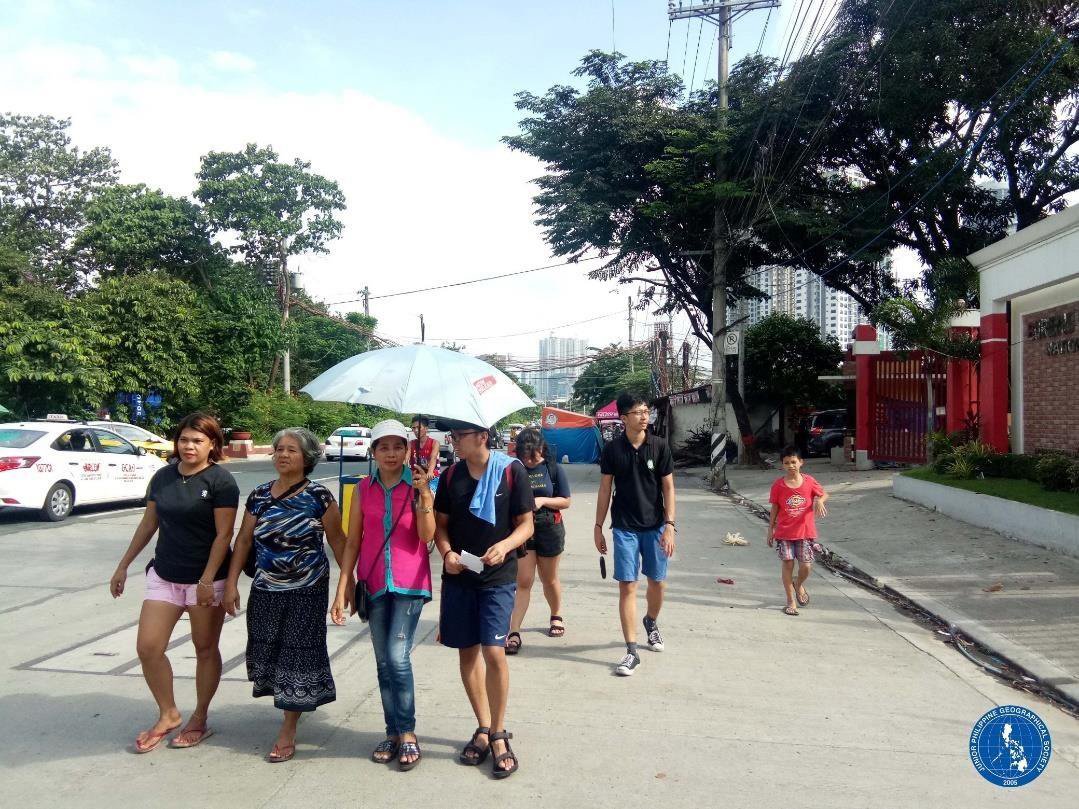
JPGS-UPD members conducting key informant walking interviews with Ate Alma, Nanay Inday, and teacher Anne.